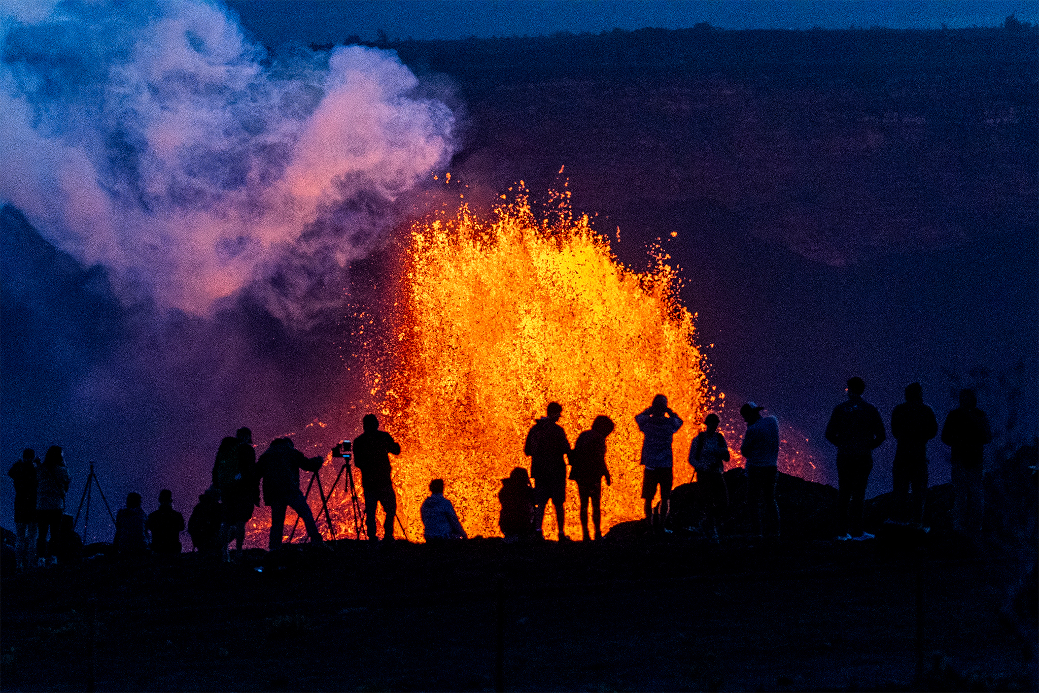
"Described as the "western hemisphere's most sophisticated weather-observing and environmental-monitoring system," the GOES-R satellite series is capable of providing data from diverse weather phenomena. This year, it captured several images of Hawaii's Kilauea volcano, which erupted from December 2024 to February 2025. In March, the lava fountain reached heights of over 1,000 feet, the highest it's been in about 50 years."
"The flames destroyed homes, schools and local landmarks, like Altadena's 140-year-old Christmas Tree Lane and Fox's Restaurant, which had been operating since 1955. Less than a year later, the U.S. Department of Justice filed two lawsuits against Southern California Edison, alleging that the company failed to properly maintain power lines in the area where the Eaton Fire first ignited in January 2025."
NOAA released striking 2025 images from GOES-R satellites documenting extreme weather across the United States. The GOES-R series provided data on Hawaii's Kilauea eruption from December 2024 to February 2025, with a March lava fountain exceeding 1,000 feet, the highest in about 50 years. Southern California wildfires—including the Palisades, Eaton and Kenneth fires—produced smoke plumes and destroyed homes, schools, landmarks and thousands of structures, killing dozens. The Eaton Fire consumed 14,000 acres and destroyed more than 9,000 structures, while the Palisades Fire burned 23,448 acres and destroyed nearly 7,000 structures. NOAA also captured a Texas–Oklahoma dust storm, a Pacific Northwest atmospheric river, and combined wildfires and dust storms in the Southern Plains.
Read at SFGATE
Unable to calculate read time
Collection
[
|
...
]