"Snow continues through Friday and tapers early Saturday, then BC/Alberta shifts to a quieter stretch before lower-confidence waves return next week. Near-term confidence is highest for this first pulse, with the best refresh in the Banff-Lake Louise corridor and lighter results in southern BC, while exposed terrain at Big White stays windy enough at times to impact comfort and some upper-mountain skiing quality."
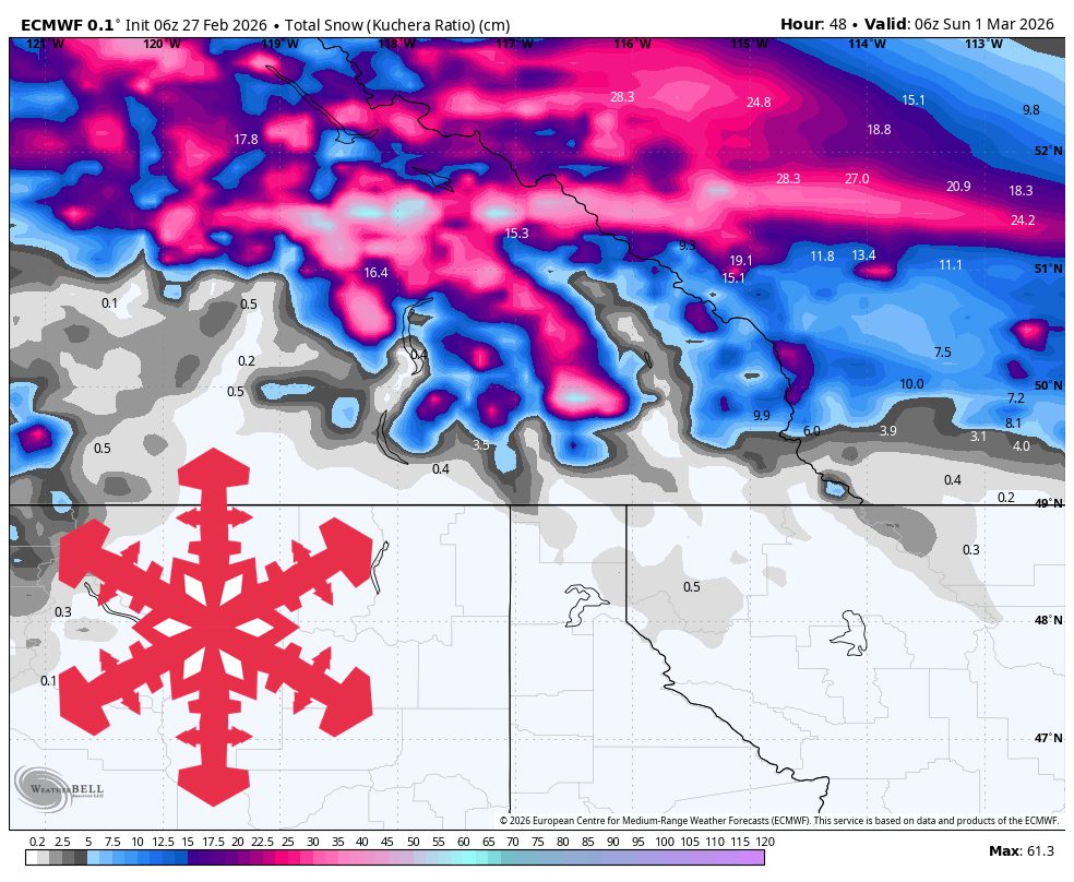
"Snow quality should run from denser at RED Mountain with SLRs near 6-10, to moderate at Revelstoke and Big White near 10-14, to lighter snow in the Alberta resorts near 14-18. Winds are mostly manageable outside exposed terrain, but Big White is the outlier with ridge gusts often in the 45-60 mph range Friday, which can make upper lifts and visibility more challenging at times."
"From Saturday afternoon through Tuesday, the models are strongly converged on a mostly dry pattern with only isolated flurries. Temperatures stay seasonable to mild in BC/Alberta, with colder overnight readings in the Alberta mountains and milder daytime temperatures in southern BC, so expect better chalk and packed powder preservation on shaded and higher terrain while lower elevations trend firmer between refreshes."
Snow persists from Friday morning through early Saturday with convergent storm timing but divergent intensity forecasts across mountains. Snow levels remain around 0 to 4,300 feet, keeping most terrain snow-covered, though southern BC experiences higher levels and denser snow. Snow quality varies by location: RED Mountain shows dense snow with 6-10 snow-to-liquid ratios, Revelstoke and Big White moderate at 10-14, and Alberta resorts lighter at 14-18. Big White faces significant wind challenges with ridge gusts reaching 45-60 mph Friday. Saturday afternoon through Tuesday brings mostly dry conditions with only isolated flurries, seasonable to mild temperatures, and eased wind impacts. Ski quality depends on existing base depth, aspect, and grooming. Confidence decreases from Wednesday as guidance diverges on subsequent wave timing and intensity.
Read at SnowBrains
Unable to calculate read time
Collection
[
|
...
]