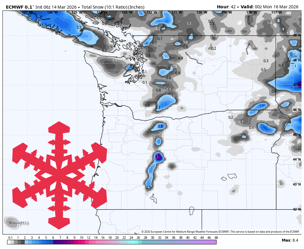
"Most Washington and Oregon resorts should only squeeze out a couple inches through Sunday before the next moisture surge drives snow levels above most summits Monday through Thursday, limiting new snow and pushing conditions toward wet surfaces and rain at many lifts."
"Snow quality is better in Washington and Whistler, where SLRs mostly run 10-16 for fairly dry recycled snow, while Oregon comes in denser at roughly 6-10. The bigger impact in Oregon is wind rather than snowfall, with exposed lifts around Timberline and Mt Bachelor seeing gusts in the 60-70 mph range at times on Saturday."
"Snow levels climb to roughly 7,000-9,000 feet on Monday, then spend much of midweek around 8,000-10,000 feet or higher, which is a poor setup for most Washington and Oregon resorts. That leaves Mt Baker with the best chance for several inches early in the week before mixed or wet precipitation takes over."
A brief snow event wraps up through Sunday with light accumulation of 1-2 inches across most Washington and Oregon resorts. Snow quality varies, with Washington and Whistler featuring drier recycled snow while Oregon experiences denser conditions. Wind gusts of 60-70 mph impact exposed Oregon lifts on Saturday before conditions improve Sunday. From Sunday night through Thursday, warming air masses push snow levels to 7,000-10,000 feet, creating poor conditions for most resorts. Mt. Baker offers the best chance for several inches early in the week before mixed or wet precipitation dominates. A cooler, wintry pattern may return late next weekend into early the following week.
#ski-resort-conditions #snow-forecast #pacific-northwest-weather #snow-levels #winter-weather-pattern
Read at SnowBrains
Unable to calculate read time
Collection
[
|
...
]