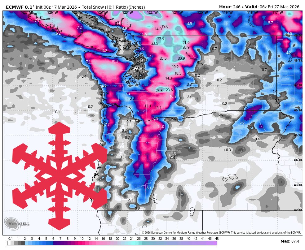
"Through Friday, the models are tightly clustered on timing, intensity, snow levels, and generally manageable winds, and that consensus points to limited ski improvement across most of the Cascades. Washington stays on the wet side of the pattern, with snow levels holding around 7,000 to 8,000 feet in the north and 9,000 to 10,000 feet in the south."
"The more meaningful reset comes Tuesday through Thursday night, when colder air and a broader Pacific storm bring the region's best chance for fresh snow, led by Mt Baker and Whistler and followed by a solid reload at several other open resorts."
"Saturday through Monday, the cooling trend is the part of the forecast with the best agreement, while precipitation coverage is where the models start to separate. Snow levels fall back toward roughly 1,000 to 3,500 feet, which should help surfaces firm up overnight and ski better than the warm midweek stretch."
The Pacific Northwest experiences springlike conditions through Friday with high snow levels limiting powder at most resorts. Washington resorts face rain-dominated conditions at lift level, while Oregon remains mostly dry with soft afternoon snow. Mt. Baker and Whistler offer the best near-term conditions. A cooling trend begins Saturday through Monday, improving snow quality as temperatures drop and snow levels fall to 1,000-3,500 feet. The most significant weather reset arrives Tuesday through Thursday night, bringing colder air and a broader Pacific storm system. Mt. Baker and Whistler lead the fresh snow potential, followed by solid reloads at several other open resorts. Model consensus through Friday shows manageable winds and limited ski improvement across most Cascades resorts.
Read at SnowBrains
Unable to calculate read time
Collection
[
|
...
]