"Every­where you look, you can find traces of the ancient Roman civ­i­liza­tion from which the mod­ern West descends. That's espe­cial­ly true if you hap­pen to be look­ing in Europe, though echoes of Latin make them­selves heard in major lan­guages used all over the world. Take, for exam­ple, the com­mon Eng­lish word itin­er­ary, mean­ing a planned route for trav­el, which descends from iter, the Latin word for a jour­ney, route, or path."
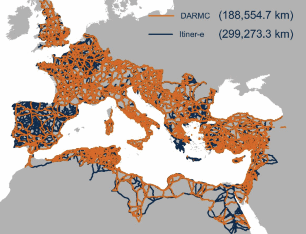
"Orig­i­nal­ly envi­sioned as a kind of "Google Maps for Roman roads," Itiner‑e is a project of Tom Brugh­mans of Aarhus Uni­ver­si­ty, and Pau de Soto Caña­mares and Adam Pažout of the Autonomous Uni­ver­si­ty of Barcelona. Its users can dig­i­tal­ly explore near­ly 300,000 kilo­me­ters of roads laid across the vast Roman Empire at its height in the mid-sec­ond cen­tu­ry - or at least as much of that net­work as edu­cat­ed guess­es can recon­struct."
Traces of ancient Roman civilization persist in modern languages and infrastructure, exemplified by the English word 'itinerary' from Latin iter and itineraria. Itiner‑e is an online map of the Roman road network that enables digital exploration of nearly 300,000 kilometers of roads reconstructed for the mid-second-century empire. The dataset integrates topographic mapping, satellite imagery, and centuries of historical records and is openly available. Researchers can be certain about less than three percent of the network, with another seven percent documented in existence but not precisely located. The project includes a confidence rating to indicate reconstruction certainty.
Read at Open Culture
Unable to calculate read time
Collection
[
|
...
]