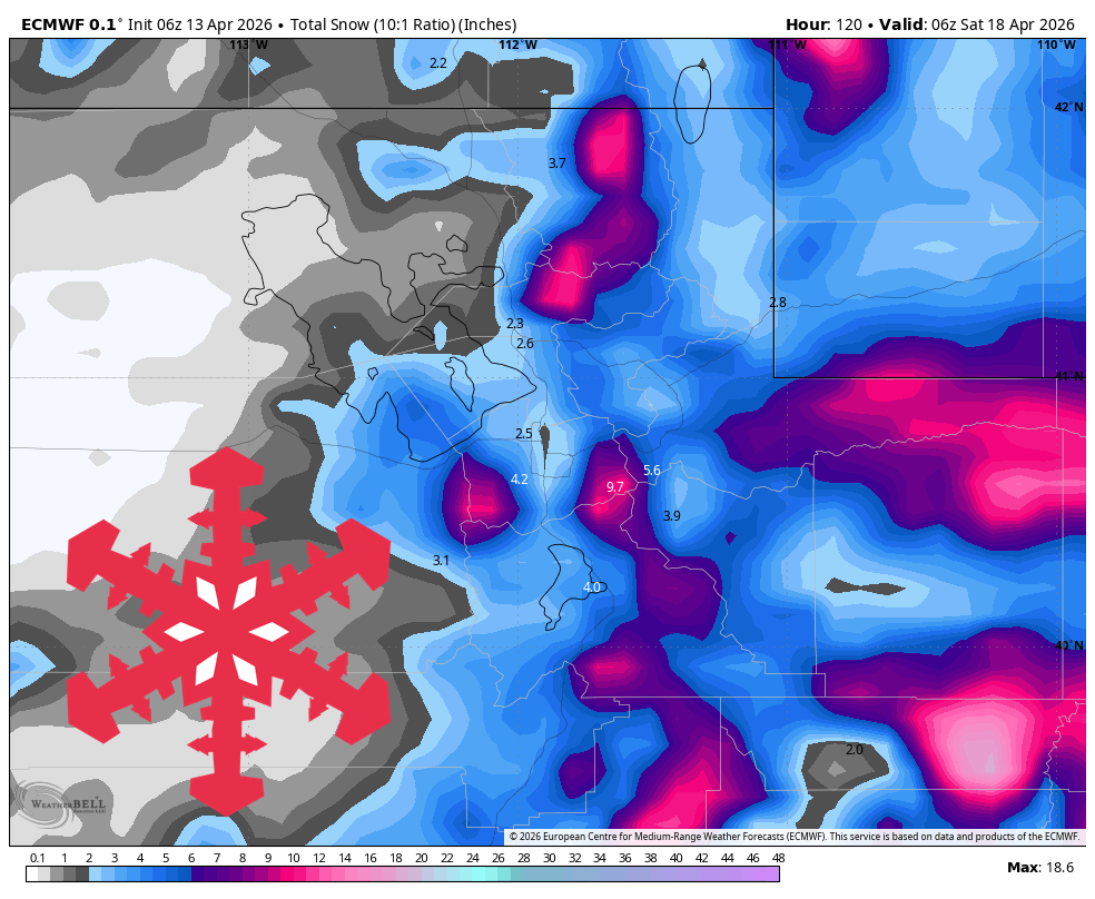
"The storm already underway Sunday night keeps winding down across northern Utah on Monday, but it continues to reload southern Utah through Tuesday. Guidance is fairly well clustered on that north-south split: Alta, Snowbird, Brighton, and Solitude are mostly looking at a coating to around 1 inch from lingering showers, while closed Eagle Point is still on track for 9-11 in through Tuesday."
"Confidence is strongest from Monday morning through Friday night, and that span is anchored by a colder storm that guidance is converging on for late Thursday through Friday. Wednesday looks like a brief lull with rising temperatures and increasing southwest wind, then Thursday's front brings the main ski impact with exposed gusts around 45-60 mph and a rapid snow-level crash from about 8,500 feet to 2,000-3,500 feet."
"Snow quality should start dense with SLRs around 3-7:1 during the frontal push, then improve into a more moderate to light 15-20:1 product Friday, and despite some spread on exact intensity, timing, snow-level evolution, and the wind."
A current storm favors southern Utah mountains through Tuesday, with moderate snow at Eagle Point despite its closure. Northern resorts like Alta and Snowbird will see minimal accumulation. A significant cold front is expected late Thursday into Friday, dropping snow levels and bringing up to a foot of snow to upper Cottonwoods. Snow quality will improve from dense to moderate as conditions stabilize over the weekend. Confidence in the forecast is highest from Monday through Friday night, with a brief lull on Wednesday before the main impact arrives.
Read at SnowBrains
Unable to calculate read time
Collection
[
|
...
]