#ridge-wind
#ridge-wind
[ follow ]
#climate-change #winter-storm #weather #extreme-weather #snowpack #heat-wave #weather-apps #snow-forecast


fromFast Company
4 days agoSee it: Air temperatures and pollution around the world are captured in real time in these animated weather maps
We created Earth in Action to provide a lens into what's happening on our planet, as it happens. Whether it's something typical, like the current air temperature, or an extreme event like a major dust storm, we wanted to provide an opportunity for people to see them.
OMG science


#climate-change


fromFast Company
2 months agoEnvironment
Why is it so cold if there's global warming? Extreme winter weather can deepen misconceptions about climate
Climate change increases global temperatures while also amplifying extreme cold events like Arctic blasts, causing record cold in some regions despite overall warming.

#winter-storm


Canada news
fromwww.theguardian.com
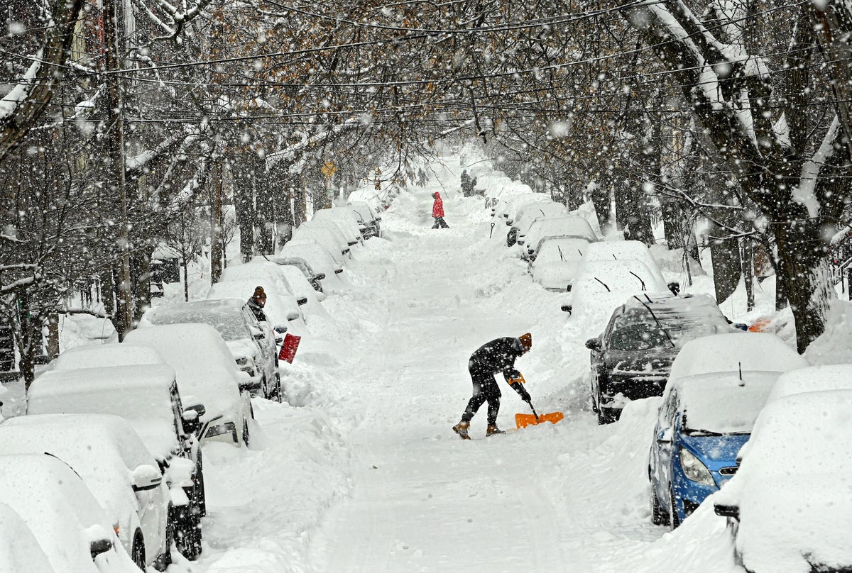
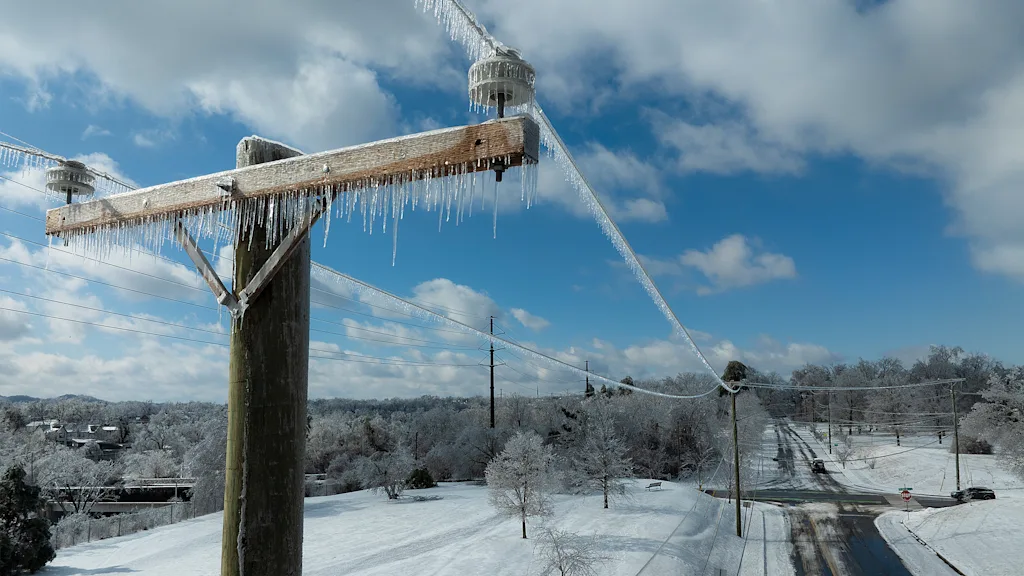
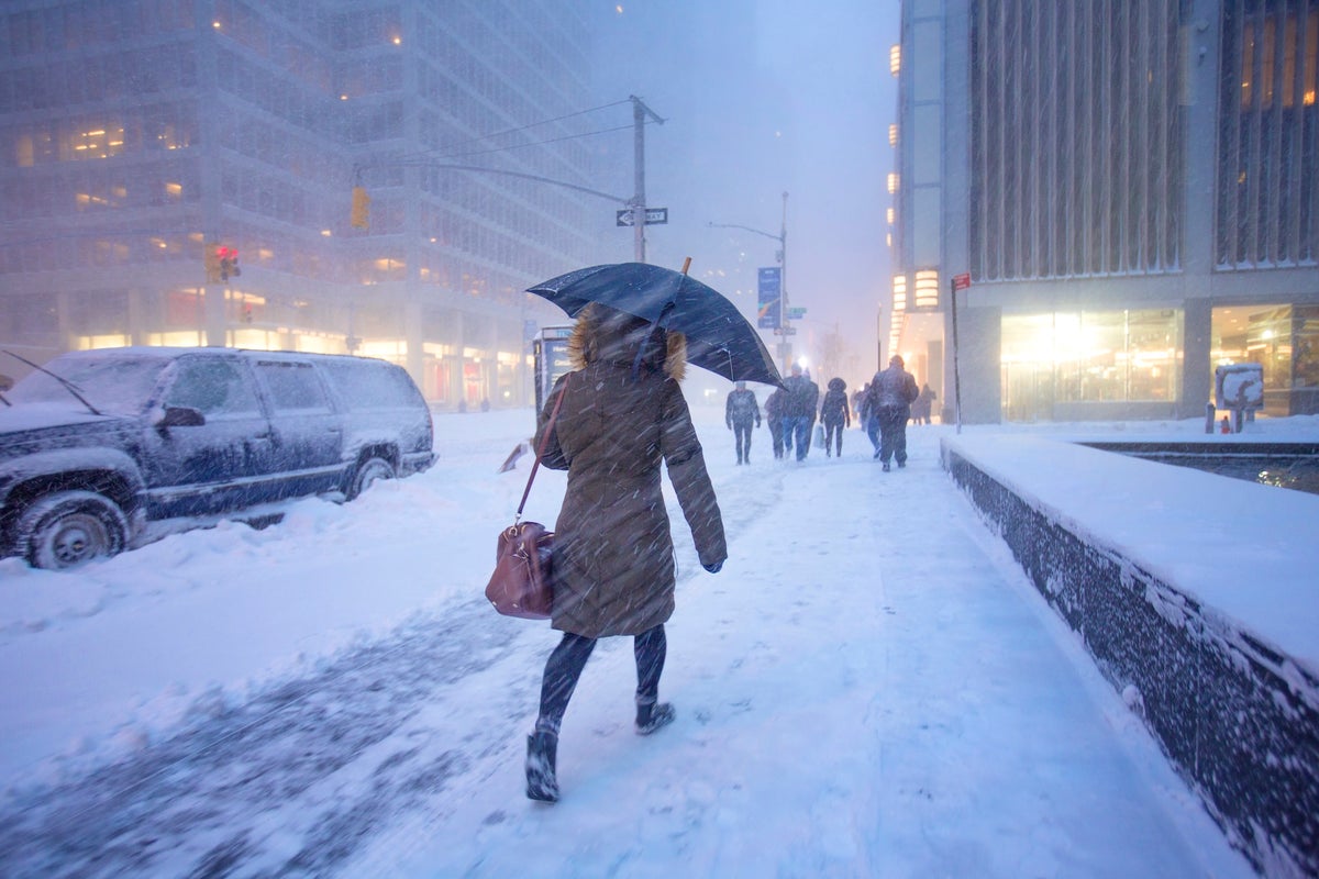
2 weeks agoWeather tracker: heavy snowfall and freezing rain sweep across US and Canada
A major winter storm is sweeping northeastern US and southeastern Canada, bringing heavy snow, freezing rain, strong winds, and a dangerous polar air mass with temperatures 10-25°C below seasonal average.
#bomb-cyclone
Chicago
fromMail Online
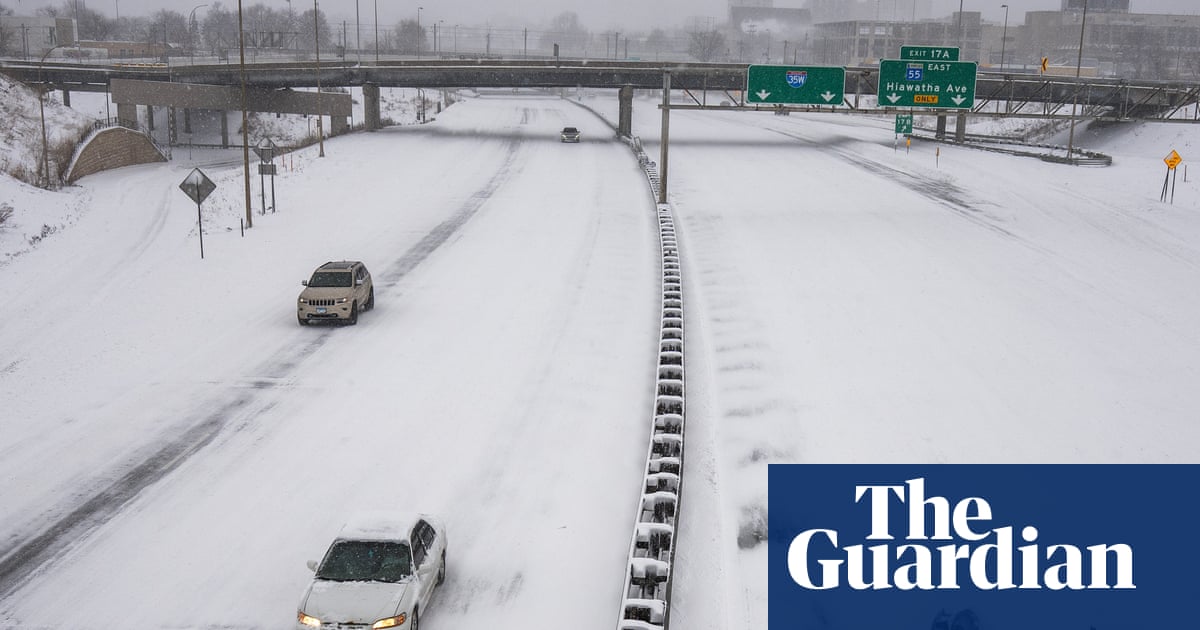
3 weeks agoHazardous weather alert for 200 million as megastorm barrels across US
A powerful megastorm will sweep across the central US from Sunday to Monday, potentially becoming a bomb cyclone with blizzard conditions, severe thunderstorms, and widespread travel disruptions across major cities.

Chicago
fromMail Online
3 weeks agoHazardous weather alert for 200 million as megastorm barrels across US
A powerful megastorm will sweep across the central US from Sunday to Monday, potentially becoming a bomb cyclone with blizzard conditions, severe thunderstorms, and widespread travel disruptions across major cities.
fromwww.npr.org
3 weeks agoSnow and wind batter parts of US, with threat of thunderstorms and tornadoes
Successive punches of snow, wind and severe weather are "going to impact the eastern half of the United States," AccuWeather senior meteorologist Tyler Roys said in an interview. Beyond the threat to lives and property, "whether it's wind gusts from a squall line, blizzard or snow, or just wind because of the storm, you're looking at several major airports being impacted."
US news

Agriculture
fromwww.pressdemocrat.com
1 month agoLow snowpack, higher temperatures cause concern for Bay Area scientists, farmers
California needs significant March rain and snow to restore water resources after an unusually warm winter, despite February storms improving reservoir levels to 70-80% capacity.
Snowboarding
fromSnowBrains
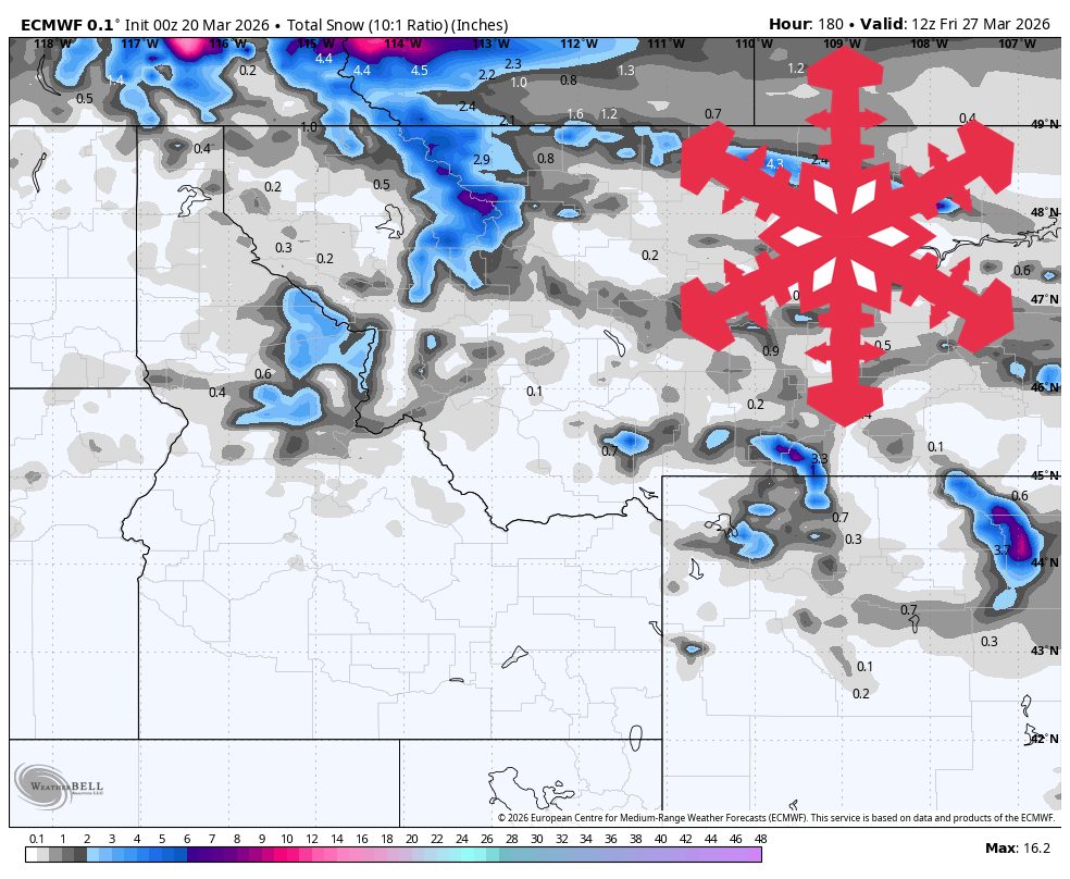
2 weeks agoSnowBrains Forecast: Springlike, Mostly Dry Pattern for Colorado Through Sunday - SnowBrains
Colorado ski resorts face warm, dry spring conditions through Sunday with afternoon temperatures in the upper 40s to 60s, minimal snowfall, and periodic ridge winds of 25-40 mph.
Snowboarding
fromSnowBrains
2 weeks agoSnowBrains Forecast: Warm, Windy, Mostly Dry Northern Rockies Through Monday - SnowBrains
A strong spring ridge brings warm, dry conditions through Friday with fast snow softening and high snow levels, followed by a weaker cold front bringing cooler temperatures and minor snow refresh over the weekend.
Environment
fromFast Company
3 weeks agoWeather whiplash to sweep U.S. with simultaneous blizzard, polar vortex, and heat dome
Extreme weather is affecting nearly all U.S. regions simultaneously, including record heat in the Southwest, snow in the Great Lakes, Arctic cold in the Midwest and East, and heavy rain in Hawaii.
fromMail Online
1 month agoThink this is bad? Scientists warn Britain is about to get BLOOD RAIN
Britain is about to be hit with showers of 'blood rain', according to experts from the Copernicus Atmosphere Monitoring Service (CAMS). This is thanks to a plume of red Saharan dust, which is currently sweeping over Europe towards the UK. When this dust mixes with Britain's persistent rain, the precipitation will take on a distinctive reddish colour - creating a phenomenon known as 'blood rain'.
Miscellaneous
Snowboarding
fromSnowBrains
3 weeks agoSnowBrains Forecast: Windy Weekend Snow Then Springlike Warmth in the Northern Rockies - SnowBrains
A cold front Saturday and lighter snow Sunday night into Monday will deliver 5-7 inches at Big Sky and 4-5 inches at Whitefish Mountain, Jackson Hole, and Bridger Bowl, followed by spring conditions with warming and firming mornings.
Snowboarding
fromSnowBrains
3 weeks agoThe Western U.S. Could See A Rare Wet Slab Avalanche Cycle Next Weekend - SnowBrains
A historic heat wave with temperatures 20-30 degrees above average could trigger rare wet slab avalanches in Colorado and Utah by introducing liquid water to weak layers in the snowpack.


Snowboarding
fromSnowBrains
3 weeks agoMountain Weather Update: Is Winter Over? Chris Tomer Answers the Question on Everyone's Lips - SnowBrains
A high-pressure dome will create a dry spell across southern ski regions while northern Rockies and Pacific Northwest receive significant snow through early April.
fromwww.kaltblut-magazine.com
2 months agoTerrain
The body is a shifting landscape transformed by surfaces and sensations. Each look captures a different tactile world: the heat of blood, the cool weight of metal, the yielding drift of water. The result is a sculptural study of how the elements carve, shield, and release the self. The materials we embody become the emotions we carry, and the body becomes a materialised exhibition of our emotions, from the pulse of Blood to the discipline of Metal to the surrender of Water.
Fashion & style
fromSilicon Canals
2 months agoThe one thing meteorologists wish people would stop doing before a winter storm hits - Silicon Canals
When I spoke with emergency management officials last year, they all mentioned the same frustrating scenario. People ignore storm warnings until the precipitation starts falling, then suddenly everyone rushes out at once. The roads become congested with anxious drivers, accidents spike, and stores run out of essentials just when people need them most. But here's what really gets meteorologists worked up about this pattern. Modern weather forecasting has become incredibly accurate, especially for major winter storms.
Public health
Snowboarding
fromSnowBrains
4 weeks agoSnowBrains Forecast: Repeated Storms Bring 4-7 Feet to Parts of the PNW Through Friday - SnowBrains
The Pacific Northwest faces a significant snow event from Sunday through Friday with colder early-week snow, a stronger midweek reload, and uncertain weekend conditions, with Washington resorts and Whistler positioned for the best snow accumulation.
Snowboarding
fromSnowBrains
1 month agoSnowBrains Forecast: Midweek Wet Snow Then Lower-Confidence Colder Storm Potential for the PNW - SnowBrains
A wet midweek Cascade storm brings 3-17 inches of snow with peak accumulation Wednesday through Thursday, favoring higher elevations initially before lower snow levels improve pass-level accumulation.
fromThe Atlantic
1 month agoThe West's Winter Has Been a Slow-Moving Catastrophe
If you are reading this on the East Coast, congratulations on the warmer weather you're finally getting this week. It was cold and snowy for a while there. Here in the West, we wish we'd been in your shoes. Spare a thought for the tens of millions of us who live on the other side of the continent, where a catastrophe is unfolding.
Environment
fromSnowBrains
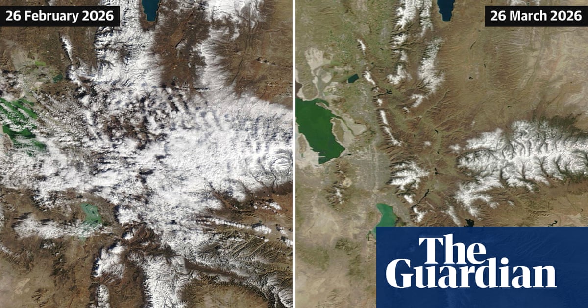
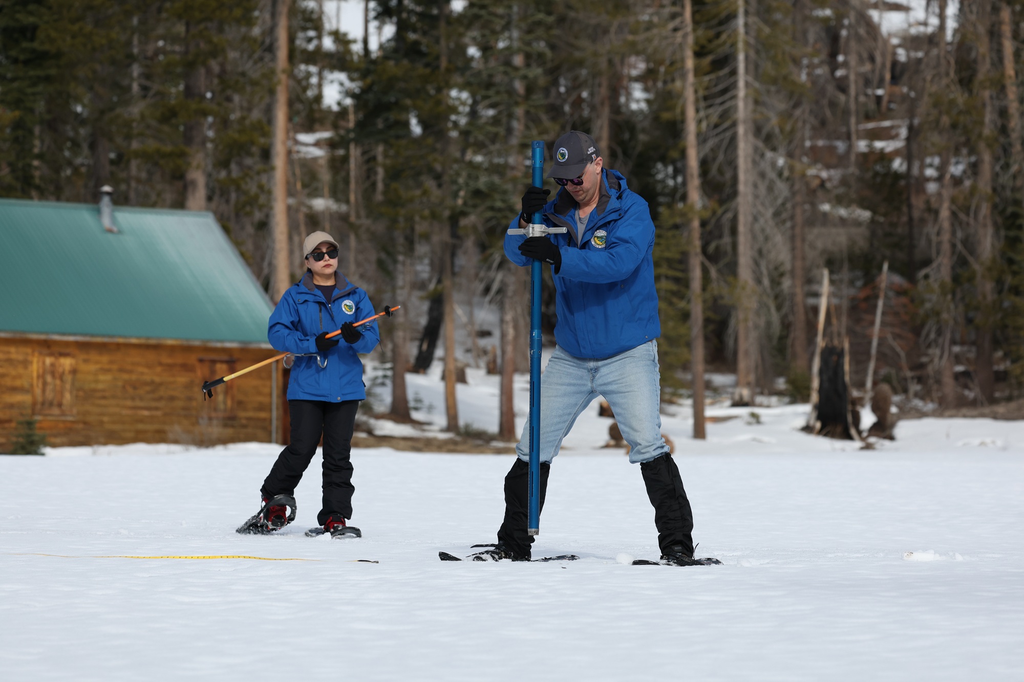
1 month agoCan Colorado's Snowpack Catch Up? - SnowBrains
To get back to average snowpack, we essentially need to have the most snow that we've ever had for the last 30 years between now and mid-April. It would be extremely difficult for Colorado to get back to a normal/average snowpack. As an example, when looking at the Independence Pass SNOTEL site in central Colorado outside of Aspen, we typically have 13 inches of snow-water-equivalent at the end of February. This year, we only have 6.7 inches of SWE.
Snowboarding
California
fromLos Angeles Times
1 month agoFirst wave of nearly a week of rain hits Southern California. Snow expected for Mammoth, Tahoe
Southern California experienced heavy rains with flood watches, wind advisories, burn-scar evacuation warnings, and forecasts of significant rainfall and mountain snow this week.
fromWIRED
2 months agoNo One Is Quite Sure Why Ice Is Slippery
The reason we can gracefully glide on an ice-skating rink or clumsily slip on an icy sidewalk is that the surface of ice is coated by a thin watery layer. Scientists generally agree that this lubricating, liquidlike layer is what makes ice slippery. They disagree, though, about why the layer forms. Three main theories about the phenomenon have been debated over the past two centuries. Last year, researchers in Germany put forward a fourth hypothesis that they say solves the puzzle.
Science
Snowboarding
fromSnowBrains
1 month agoSnowBrains Forecast: Wet Early Snow Then Variable Conditions for Colorado - SnowBrains
Mountain snowfall peaks through Thursday with heavy wet snow and strong winds, followed by uncertain lighter accumulations and a return to warmer, quieter conditions by the weekend.
fromHigh Country News
2 months agoHow geology not only shapes the world, it shapes us - High Country News
My father was a petroleum geologist. A lot of my childhood, he was gone, away on oil rigs in the Powder River Basin and remote parts of Wyoming, living in man camps long before cellphones. We had to wait days to talk to him. When he went into the nearest town to shower, he'd find a payphone and call us. I was always breathless with news.
Science
fromSnowBrains
2 months agoSnowBrains Forecast: 2 Feet of Additional Snowfall for the Rockies, Tetons This Week - SnowBrains
A busy January 5-9 stretch brings frequent light-to-moderate refreshers across the Northern Rockies, with the deepest totals focused on Idaho and the Tetons while snow quality trends better and better as the week turns colder. Snow levels start relatively higher in parts of Idaho early in the window, then steadily crash through midweek, flipping more of the precipitation to snow and boosting snow-to-liquid ratios into the 14-20:1 range for a noticeably drier, fluffier feel late Wednesday into Thursday;
Snowboarding
Environment
fromwww.mercurynews.com
2 months agoMeteorologists blame a stretched polar vortex, moisture, lack of sea ice for dangerous winter blast
Warm Arctic waters and cold land are elongating the polar vortex, bringing subzero temperatures, heavy snow, and crippling ice across much of the United States.

fromSnowBrains
2 months agoThe West Waits for Snow as the East Braces for a Potentially Historic Storm - SnowBrains
WeatherAs forecasters anxiously watch models for better agreement, one thing is clear: a major winter storm-named Winter Storm Fern by The Weather Channel-is forecast to impact a vast portion of the United States this weekend, bringing a dangerous combination of heavy snow, ice, and extreme cold to much of the country. Winter Storm Fern is expected to impact more than 230 million people across roughly two-thirds of the U.S., stretching across approximately 33 states.
Snowboarding
[ Load more ]