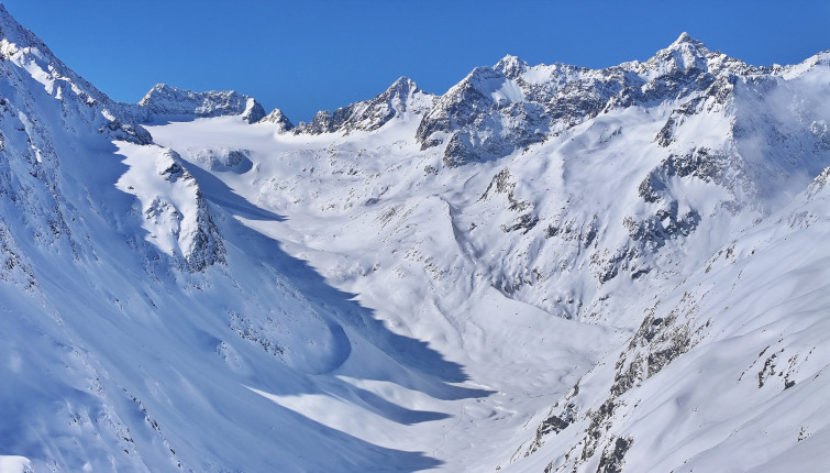
#snow-conditions-and-corn-snow
#snow-conditions-and-corn-snow
[ follow ]
#skiing #snowfall #snowpack #weather #colorado #spring-skiing #ski-resorts #safety #avalanche #ski-season #snow-levels


fromSnowBrains
2 days agoLate Season Storm Brings Welcome Conditions Refresh to Mt. Rose Ski Tahoe, NV - SnowBrains
"We're always glad to welcome winter back, and this latest round of snow has ensured there are still great turns to be had as our spring season continues. Late season powder days are a bonus, and with the spring events and deals we have planned, it's not too late to get up here for some great skiing and riding!" - Mike Pierce, Marketing Director, Mt. Rose Ski Tahoe
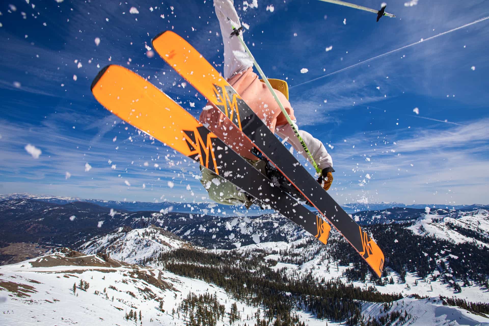
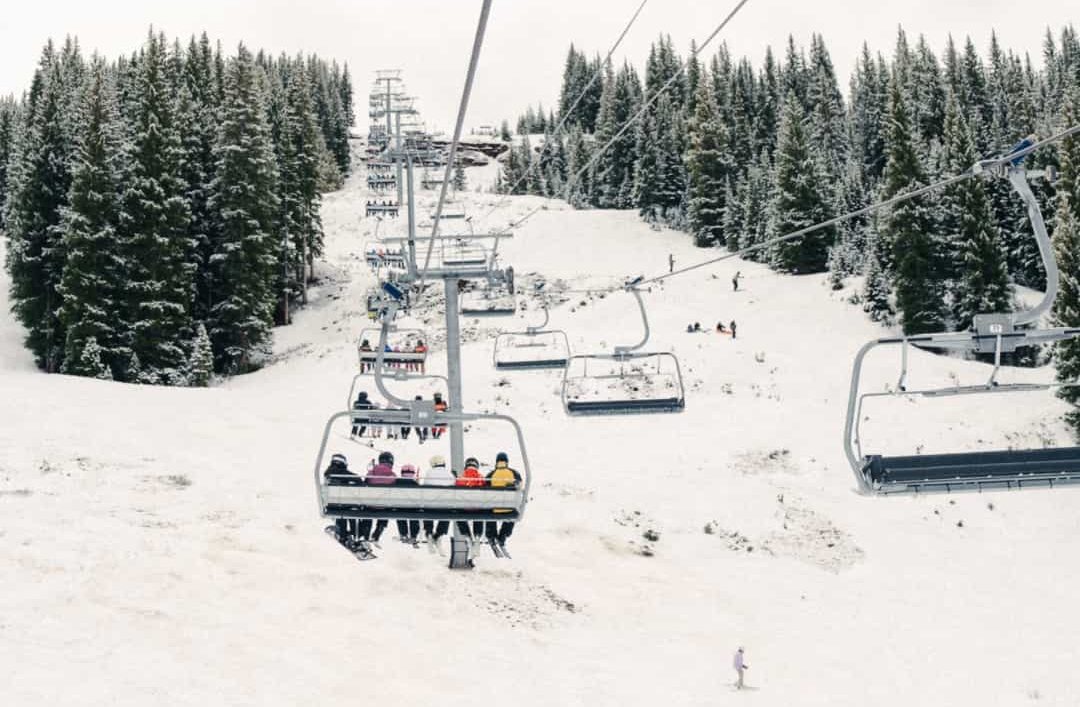
Snowboarding

fromUnofficial Networks
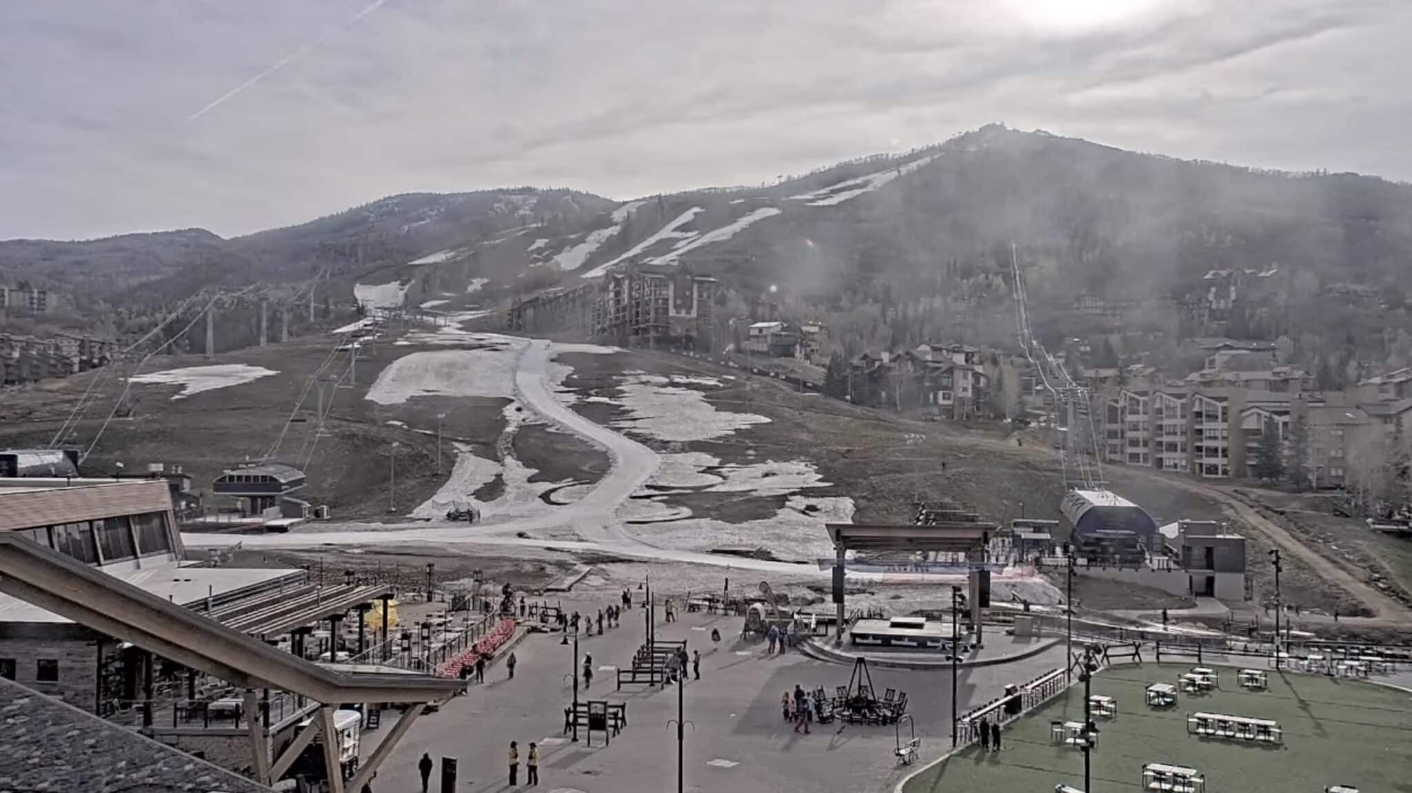
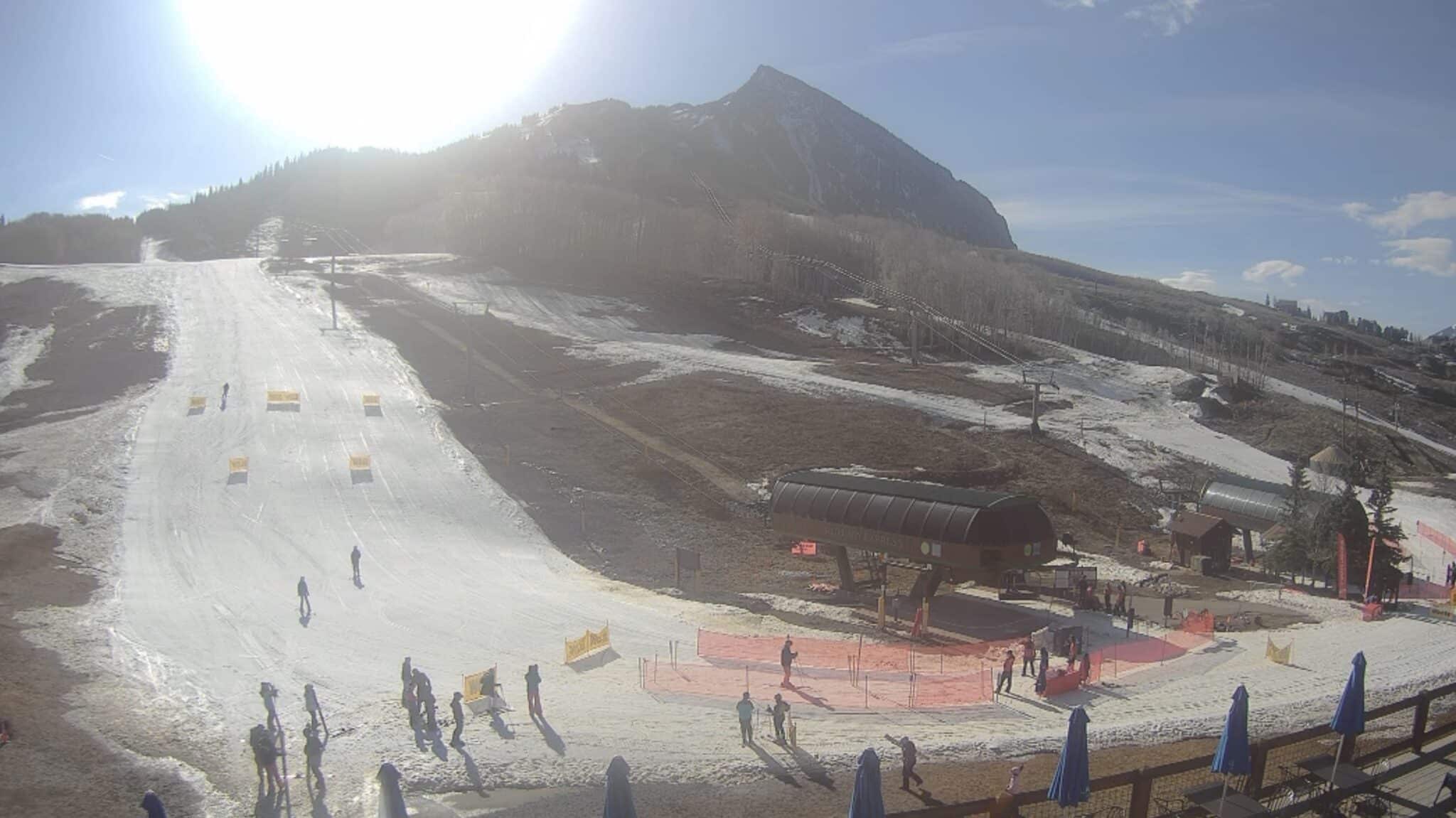
2 days agoYet Another Colorado Ski Resort Is Wrapping Things Up Early This Weekend
"As we wrap up the season, I want to thank our loyal guests who showed up smiling day in and day out to support their local hill. I also want to thank our dedicated staff whose immense efforts and pride in their work kept Eldora running all season long. We hope everyone comes to celebrate the season with us this weekend." - Andrew Gast, Eldora's president and general manager.
Snowboarding
fromSnowBrains
2 weeks agoWet Slab Weekend Ahead: Persistent Warm Temperatures Threaten to Wake Up Persistent Weak Layers - SnowBrains
"Don't entirely trust any of these slopes until temperatures dramatically cool down. Each day, the sun climbs higher in the sky, and the oppressive heatwave sends meltwater deeper into colder snowpacks."
Snowboarding
Snowboarding
fromSnowBrains
2 weeks agoSnowBrains Forecast: Springlike, Mostly Dry Pattern for Colorado Through Sunday - SnowBrains
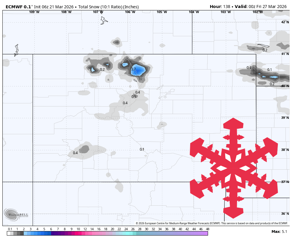
Colorado ski resorts face warm, dry spring conditions through Sunday with afternoon temperatures in the upper 40s to 60s, minimal snowfall, and periodic ridge winds of 25-40 mph.
Snowboarding
fromSnowBrains
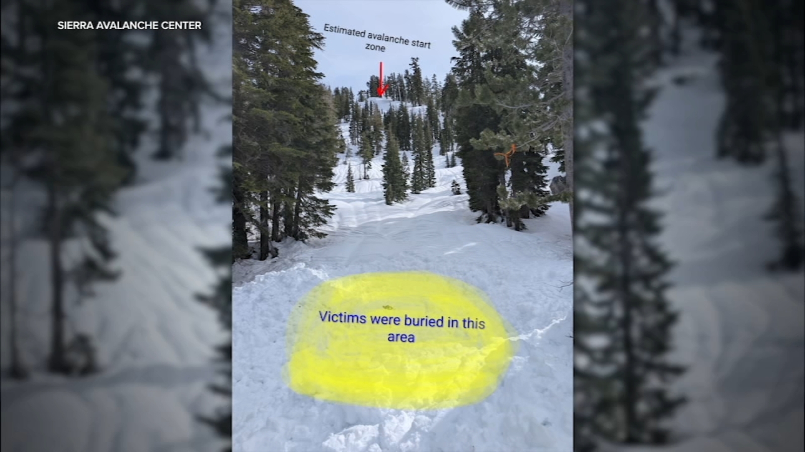
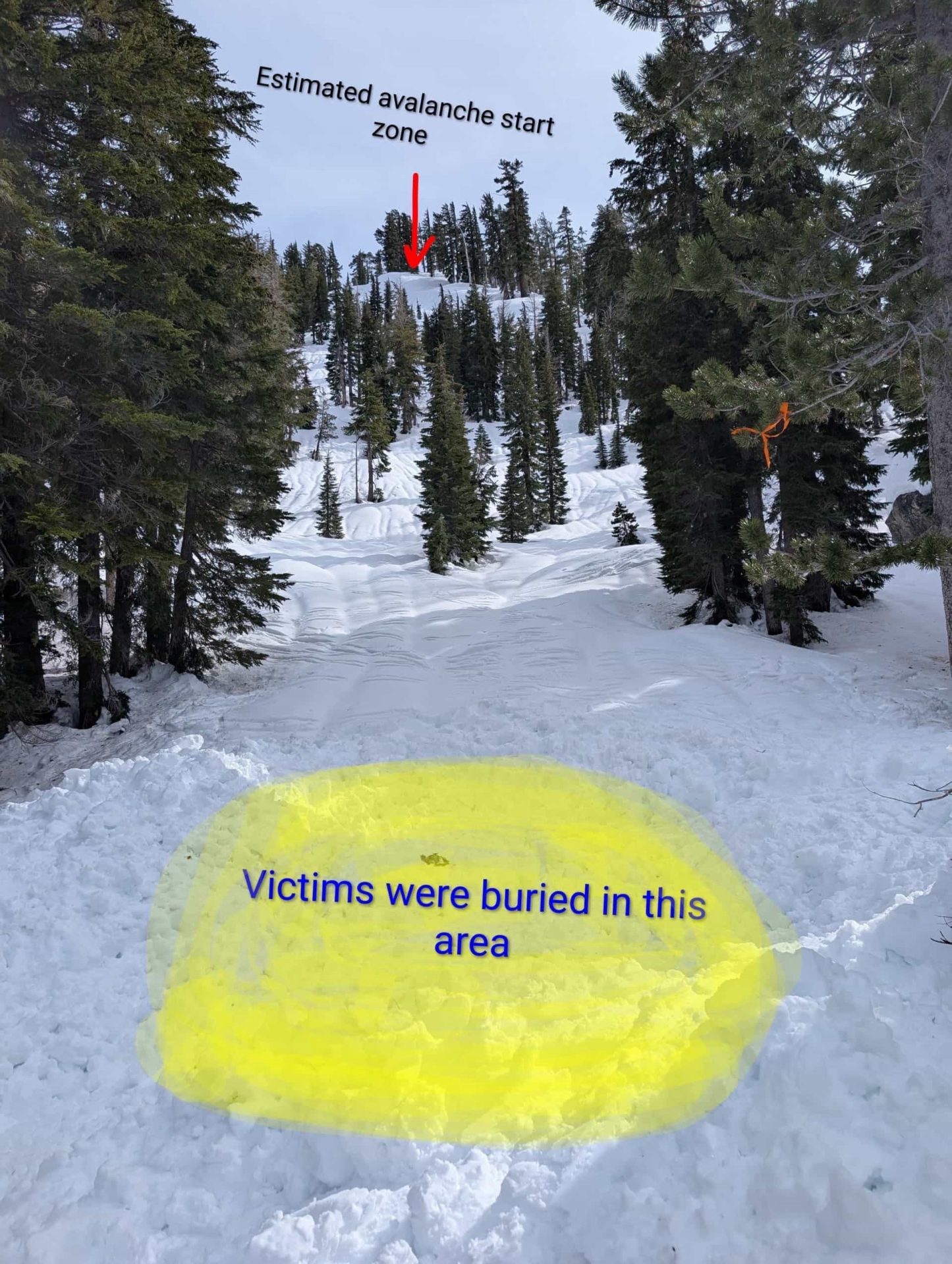
3 weeks agoThe Western U.S. Could See A Rare Wet Slab Avalanche Cycle Next Weekend - SnowBrains
A historic heat wave with temperatures 20-30 degrees above average could trigger rare wet slab avalanches in Colorado and Utah by introducing liquid water to weak layers in the snowpack.
fromUnofficial Networks
3 weeks agoRunaway Snowboard Leaves Path of Destruction Taking Out Multiple Skiers
Runaway snowboards were a cause of great concern in the early days of snowboarding as snowboards don't have breaks like skis. This concern was justified in many ways as proto snowboard bindings much less secure and reliable than modern systems using simple straps, rubber components, or basic buckles that could loosen or fail more easily during a crash.
Snowboarding


Snowboarding
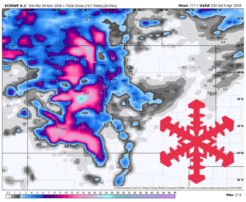
fromSnowBrains
3 weeks agoMountain Weather Update: Is Winter Over? Chris Tomer Answers the Question on Everyone's Lips - SnowBrains
A high-pressure dome will create a dry spell across southern ski regions while northern Rockies and Pacific Northwest receive significant snow through early April.

fromUnofficial Networks
1 month ago5 Ski Resorts That Average 400"+ of Snow (And Why They're Snow Magnets)
Mt. Baker is the PNW's snow vacuum. It's close enough to the Pacific to get storm after storm, and the North Cascades do what they do best: force moist air straight up, wring it out, and bury everything in sight. Maritime storms roll in wet and heavy, then pile up fast when they hit terrain.
Snowboarding
fromSnowBrains
1 month agoWhere Will it Be Deep This Week? These are the Top 5 Forecasted Resorts in North America for the Next 10 Days - SnowBrains
Fresh snow is what turns ordinary runs into powder days, and every skier knows the thrill of waking up to see a few extra inches (or feet) on the mountain report. Whether you're chasing the deepest conditions or just living vicariously through other people's powder days, it's worth knowing where the flakes are stacking up.
Snowboarding
fromSnowBrains
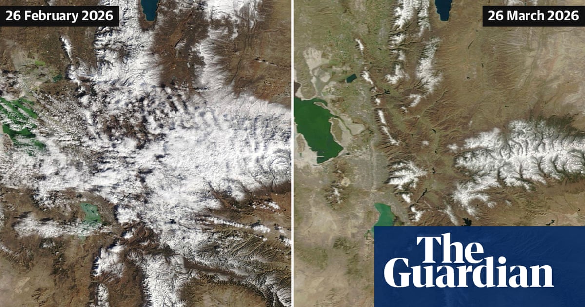
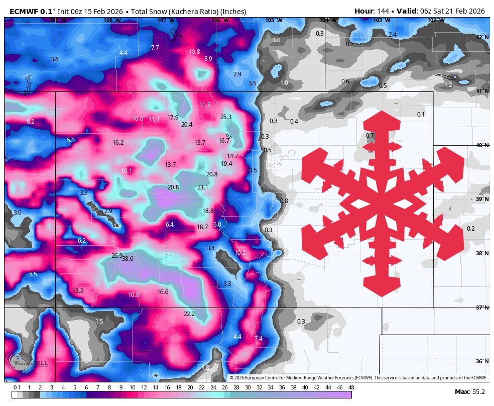
1 month agoCan Colorado's Snowpack Catch Up? - SnowBrains
To get back to average snowpack, we essentially need to have the most snow that we've ever had for the last 30 years between now and mid-April. It would be extremely difficult for Colorado to get back to a normal/average snowpack. As an example, when looking at the Independence Pass SNOTEL site in central Colorado outside of Aspen, we typically have 13 inches of snow-water-equivalent at the end of February. This year, we only have 6.7 inches of SWE.
Snowboarding
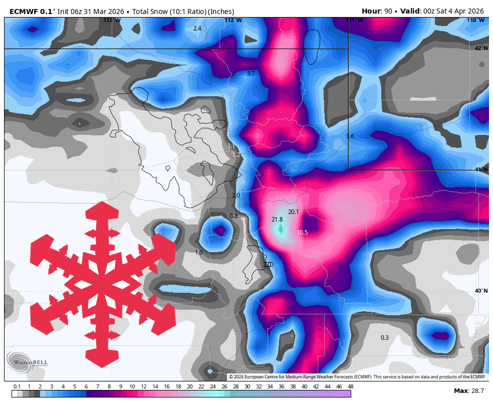
fromSnowBrains
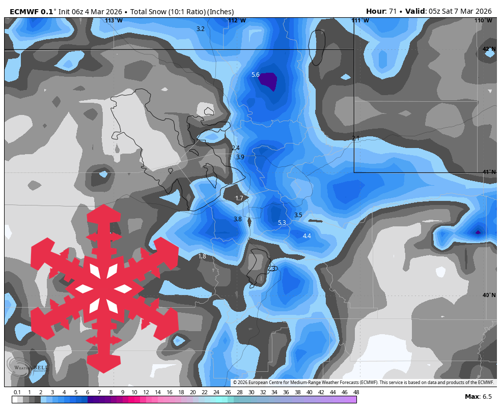
1 month agoSnowBrains Forecast: Warm Start Then Up to 8 Inches for Utah, Bigger Late-Week Potential - SnowBrains
Thursday night through Saturday trends warm and mostly quiet, and guidance is converging on that timing and lower-impact intensity. Expect only spotty lingering snow showers early, then long dry breaks with mountain temperatures generally in the upper 20s to lower 40s and snow levels often around 8,000 to 10,500 feet.
Snowboarding
Snowboarding
fromSnowBrains
1 month agoSnowBrains Forecast: Wet Early Snow Then Variable Conditions for Colorado - SnowBrains
Mountain snowfall peaks through Thursday with heavy wet snow and strong winds, followed by uncertain lighter accumulations and a return to warmer, quieter conditions by the weekend.
Snowboarding
fromSnowBrains
1 month agoWhere Will it Be Deep This Week? These are the Top 5 Forecasted Resorts in North America for the Next 10 Days - SnowBrains
Ski resorts across North America will receive varying cumulative snowfall over the next 10 days, with some receiving the most snow in the coming week.


fromSnowBrains
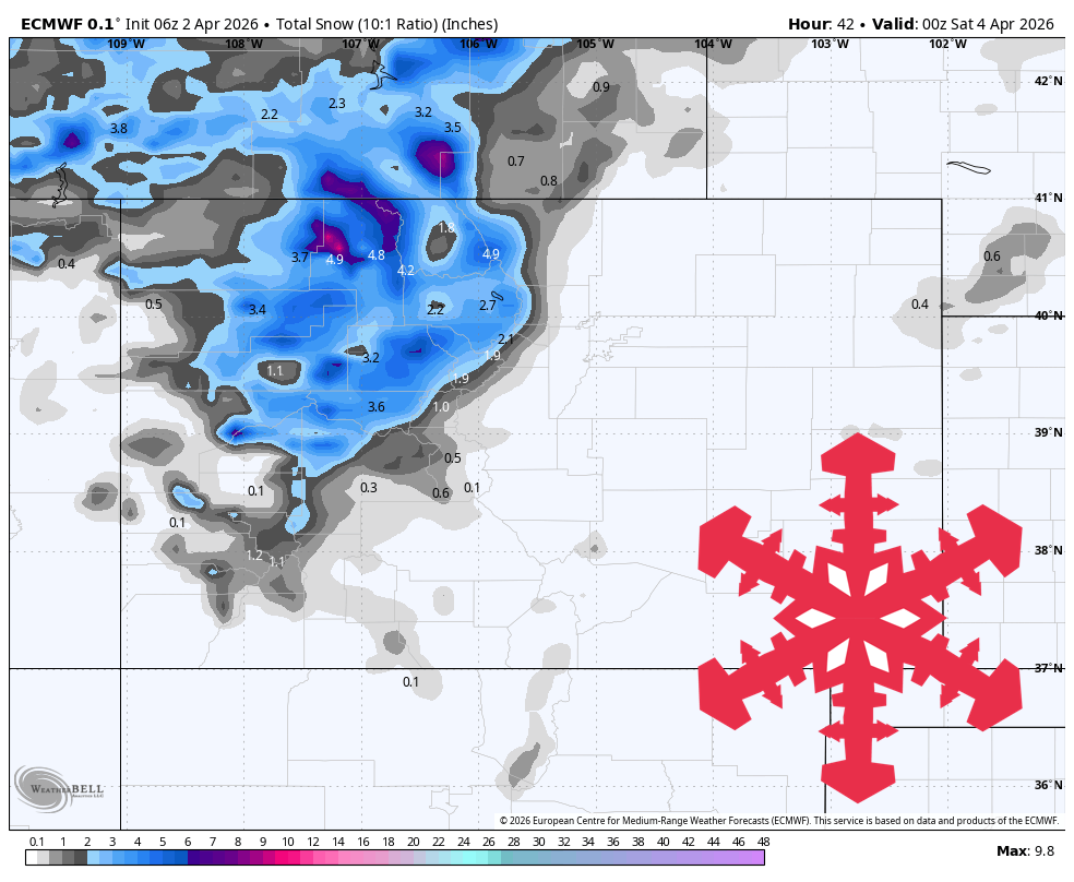
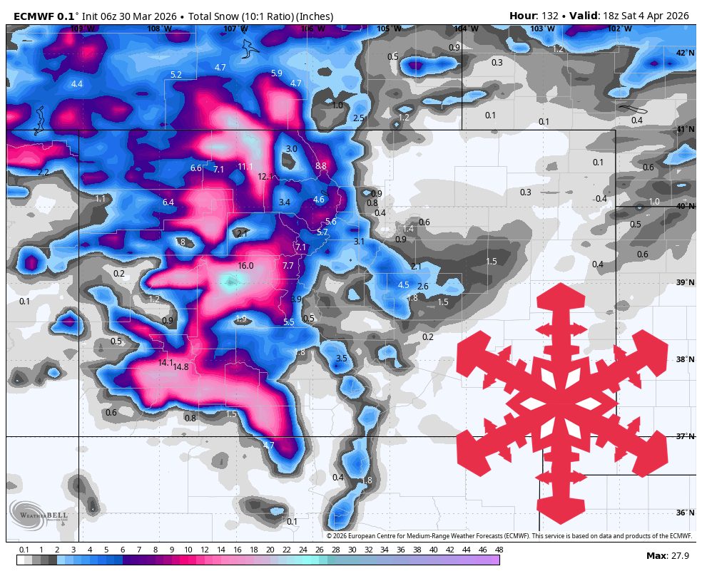
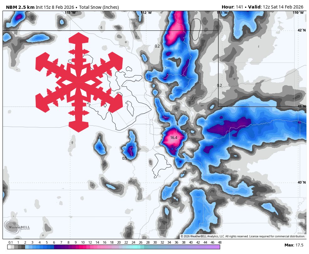
1 month agoSnowBrains Forecast: Snow Finally Returns to Colorado With 1 Foot This Week - SnowBrains
The midweek stretch looks like the most reliable window for fresh turns, with the steadiest snow lining up Wednesday night into Thursday and lighter add-ons into Friday. Snow levels run a little high early, then step down late week, so snow quality should improve as the storm cycle matures. Some areas could see the next wave begin as early as Sun night (02/15), but confidence drops quickly with lead time and placement.
Snowboarding

[ Load more ]